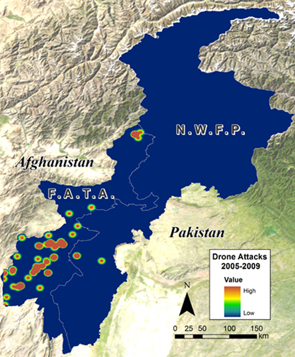
Density map of US Drone Strikes in northwest Pakistan, 2005 – 2009 (based on publically available information only). Click to enlarge. (c) Amnesty International. Analysis conducted and map produced by AAAS.
Density map of US Drone Strikes in northwest Pakistan, 2005 – 2009 (based on publically available information only). Click to enlarge. (c) Amnesty International. Analysis conducted and map produced by AAAS.