The Story Behind The Nigeria Satellite Images

Satellite image of the village of Doro Baga (aka Doro Gowon) in north-eastern Nigeria taken on 2 Jan 2015. Image shows an example of the densely packed structures and tree cover. Satellite image 2, taken on 7 Jan 2015, shows almost all of the structures razed. The inset demonstrates the level of destruction of most structures in the town. The red areas indicate healthy vegetation.

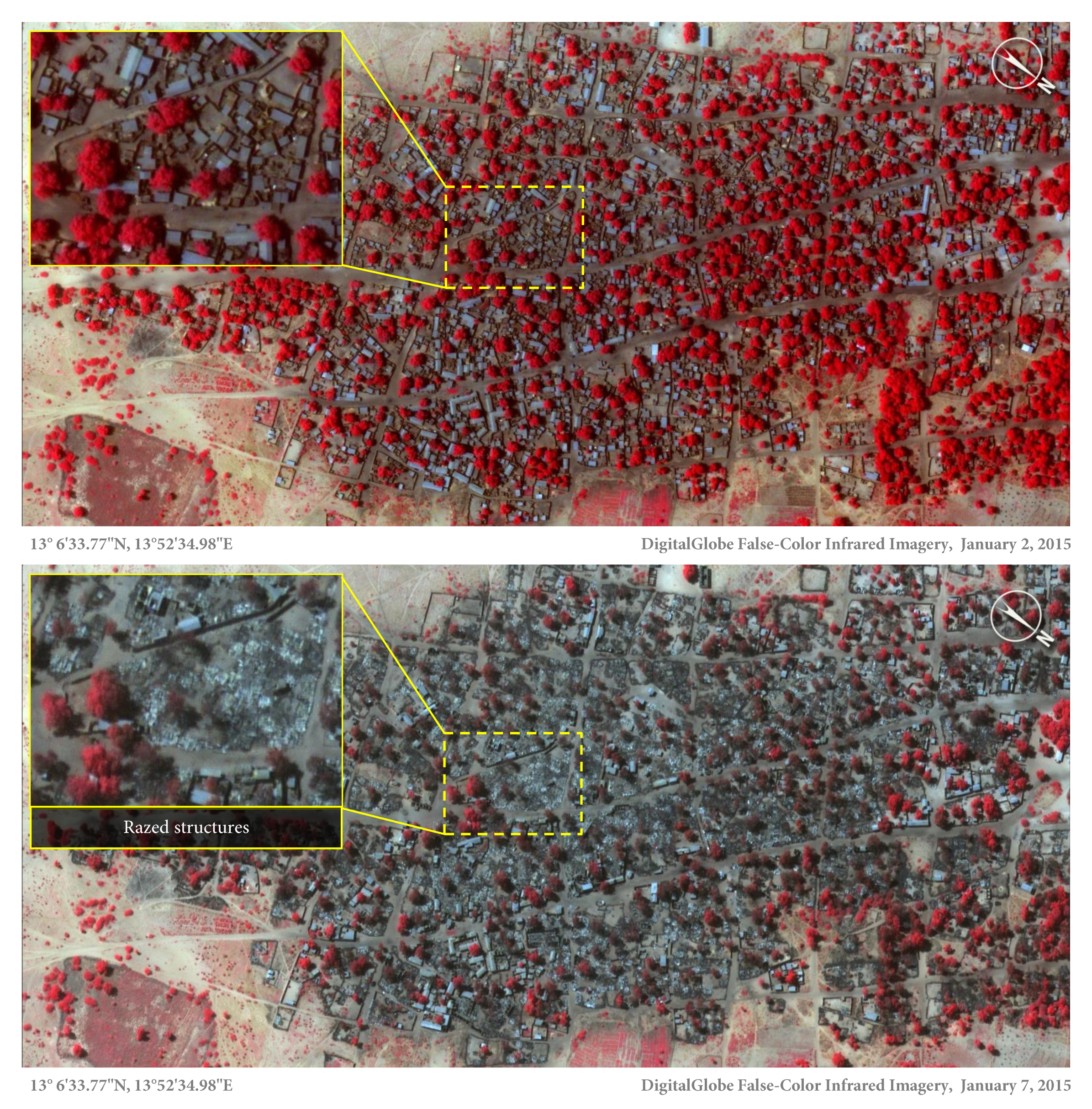
The town of Doron Baga, Nigeria, before it was largely razed by Boko Haram. 2 January 2015 © DigitalGlobe

Amnesty International today released satellite images that show the impact of a horrific Boko Haram attack in northeast Nigeria last week. The images, combined with several testimonies, provide shocking evidence of how the conflict is dramatically escalating, with dire consequences for civilians. SEE THE REST OF THIS POST